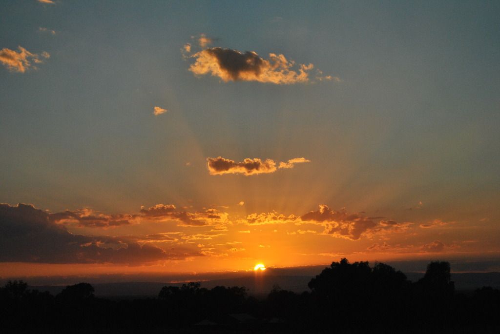
The beginning of our High country escape started here in Glenrowan, the location of Ned Kelly's last stand in 1880. Our 'basic' Accommodation ($120 night for 4 of us) consisted of a 3 bedroom unit complete with kitchen facilities, bathroom & toilet. With a cooler 14 degrees and stunning morning sunrise, what a perfect start to our expedition into an attractive piece of Victoria.
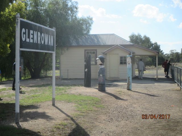
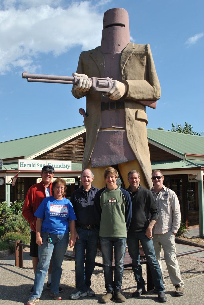
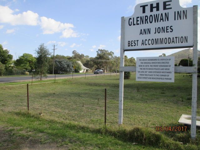
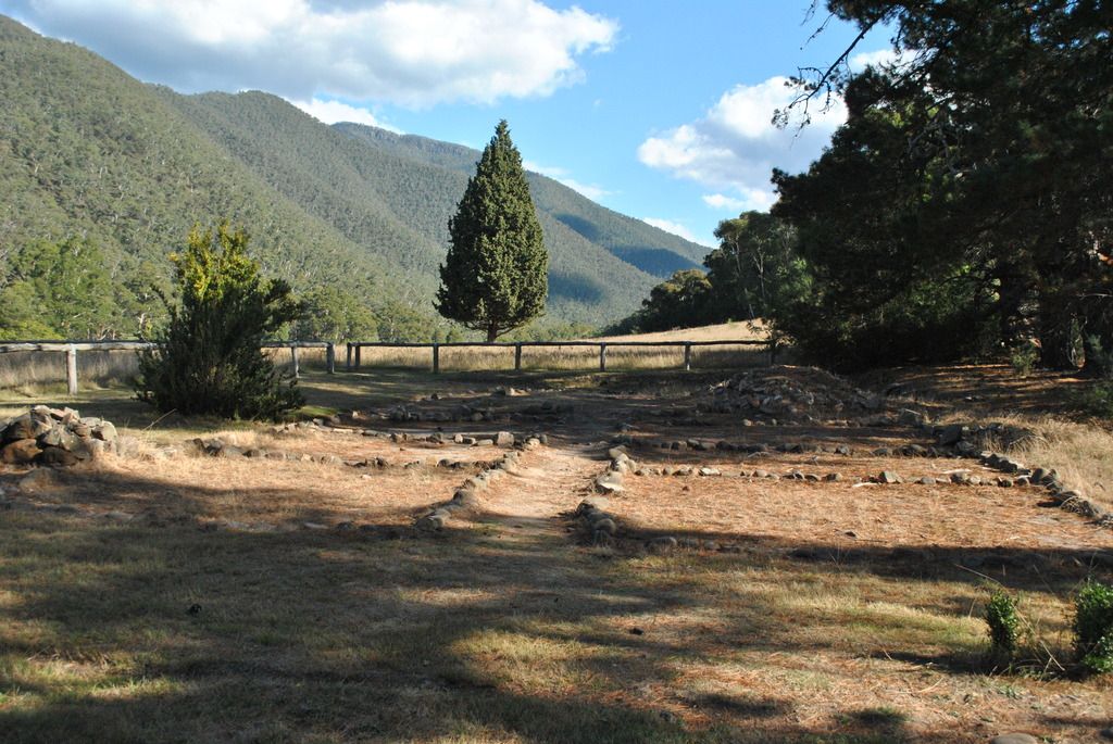
On the 28th of June 1880 after taking 60 people hostage at the Glenrowan Inn, owned by Ann Jones, the infamous Bushranger Ned Kelly & the Kelly gang (Ned, Ned’s brother Dan, friends Steve Hart & Joe Byrne) engage in a shootout with Police. Ned is shot in the foot, arm & thumb while Joe is shot while sitting at the bar (downing a beer), bleeding to death. Dan & Steve are believed to have taken poison prior to the fire, later found in the burnt out remains of the Hotel, set alight by Police. Ned Kelly was finally shot and captured after returning early hours of the following morning still clad in armor, looking huge & grotesque in the early mist. Although none of the original buildings remain, a sign marks the spot where Ann Jones' Glenrowan Inn once stood. A replica of the railway station building & a collection of wooden pole people representing the places where people stood during the siege. We also visited the site of the station master's house and where Ned was finally arrested & the goal where Ned was held awaiting the journey by train to Melbourne. This was the one and only time the armor, designed by the boys, was ever used.
During 1867 after the death of Ned's father John (Red) the Kelly family moved to Greta not far from here. Although we tried to find the remains of the homesteads red brick chimneys, they were nowhere to be found.
Keri met a lady earlier whose grandparents were the Kelly’s neighbors here in Greta and a bloke whose grandfather rode to school with Ned back in Avenel.
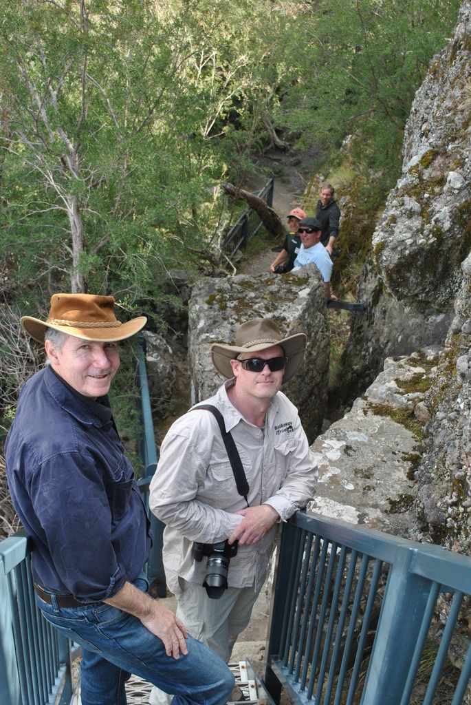
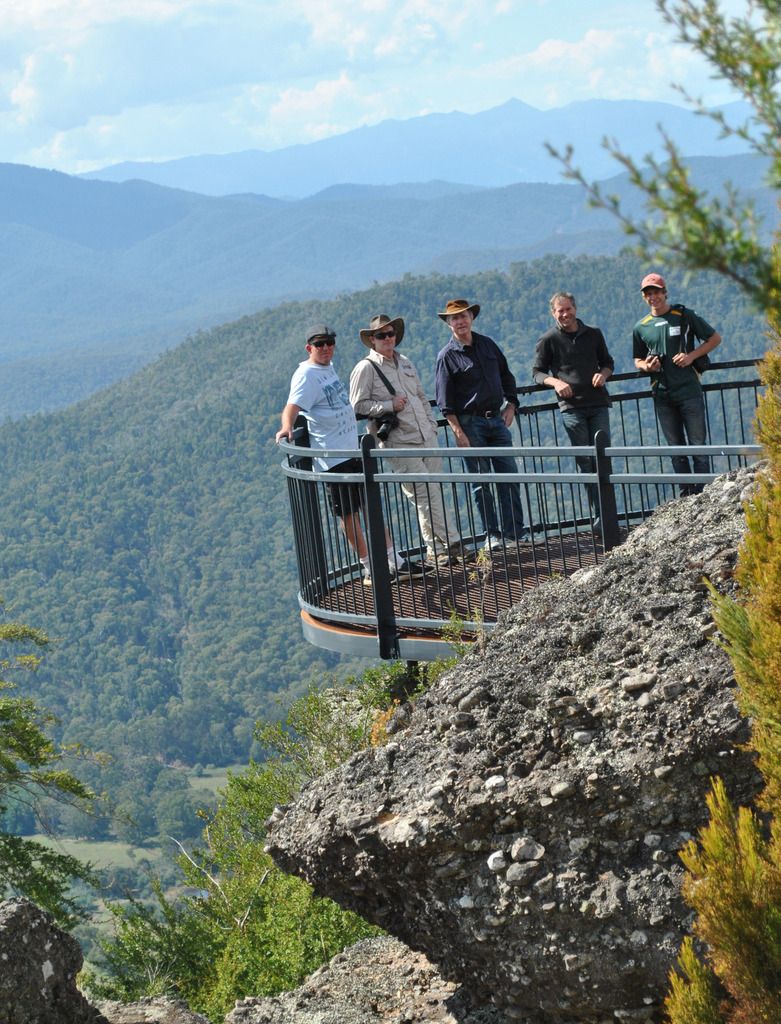
During Ned’s early years (aged 14) he met up with Harry Power who taught Ned the ropes of being a Bushranger. Powers Lookout on the Mansfield Whitfield Rd. 22km’s South West of Whitfield took us through some beautiful countryside and a scenic walk through the bush to some ladders up to Powers lookout. With excellent views over the valleys below, Bushranger Harry Power staked his hideout watching over approaching troopers below. Harry was eventually captured at this location in 1870, dobbed in by Jack Lloyd (Kelly family member) for the reward of £500.
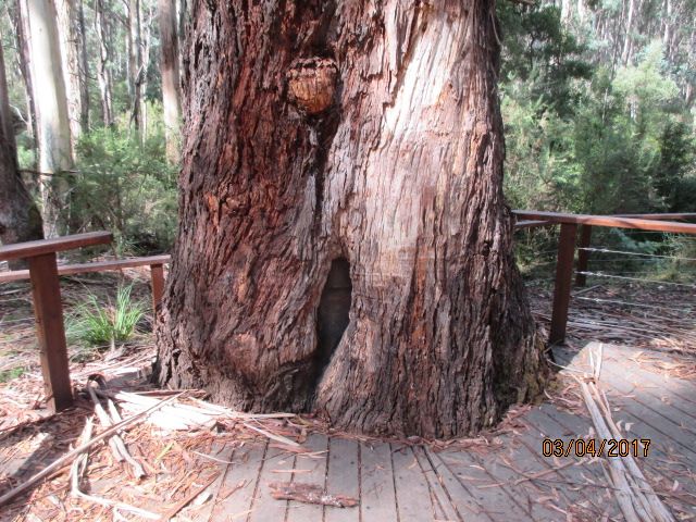
Stringy Bark Creek on the Tatong Tolmie dirt road is where in Oct 1878 the fatal shooting of 3 Police officers by the Kelly gang took place. From the car park it is a short easy walk through the bush to the supposed site of the alteration between Police & Kelly boys. A stray bullet during the shootout took refuge in a nearby tree. It became known as the Kelly tree. Sadly saw millers chopped the tree down in 1908. A second tree was chosen; white ants destroyed it in the 1940’s. Third tree chosen, one near the Stringybark creek and the former tree, carving the names of the 3 Police officers into its trunk. In 1985 the tree was officially named the Kelly tree replacing the carved names of the officers with a metal plaque representing Kelly’s armor.
Day 1 of the High Country adventure.
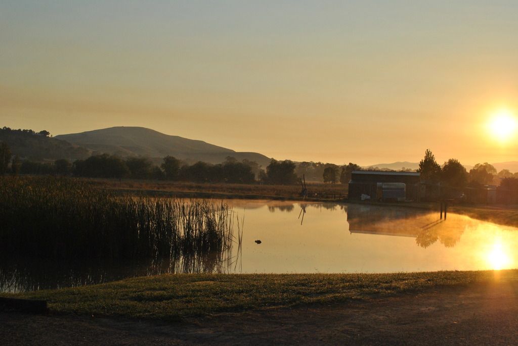
While Don and Cos went foraging for breakfast in town, some of us enjoyed an early morning sunrise over the camps dam.
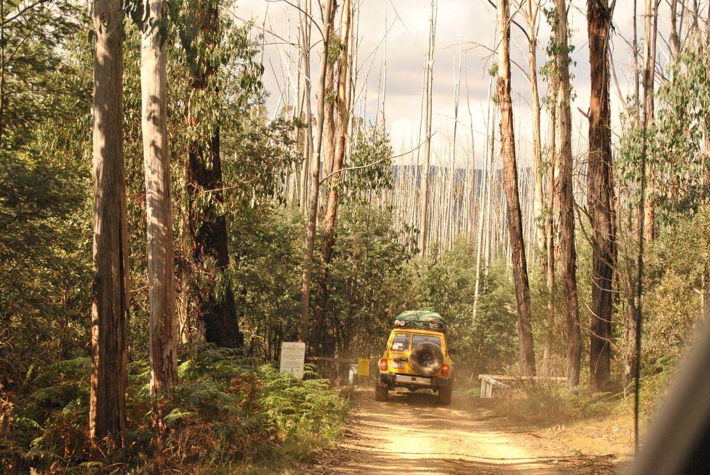
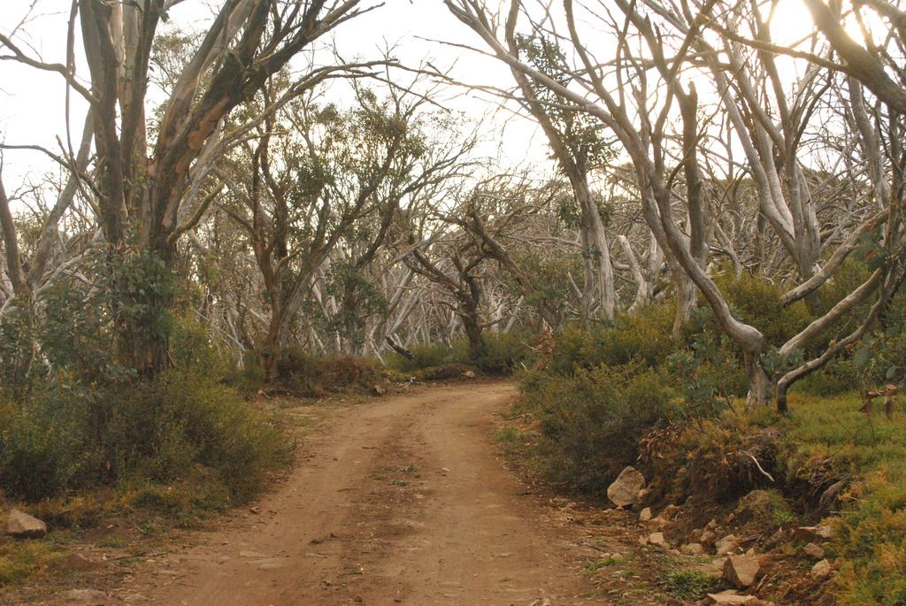
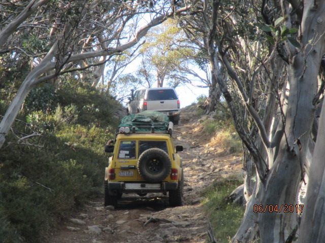
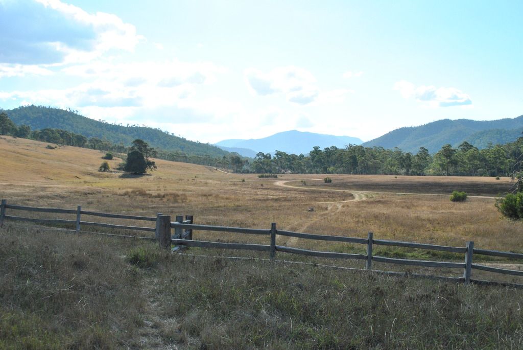
With 7 degrees displayed on our dash board we had our sights set firmly on reaching Craig’s Hut by sunset but not before visiting the Howqua Hills historic area where all the rivers run. The road takes us along the Howqua Hills Road, onto Brocks Road, Bluff Link Rd, 16 Mile Jeep TK, Bindaree Road before linking up with the main Circuit Track near Mt Buller. A number of campgrounds (all free) dotted along the Howqua River provides great get away for families. The peace & tranquillity of the bush is so welcoming.
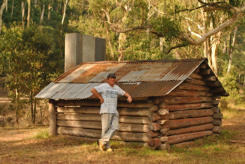
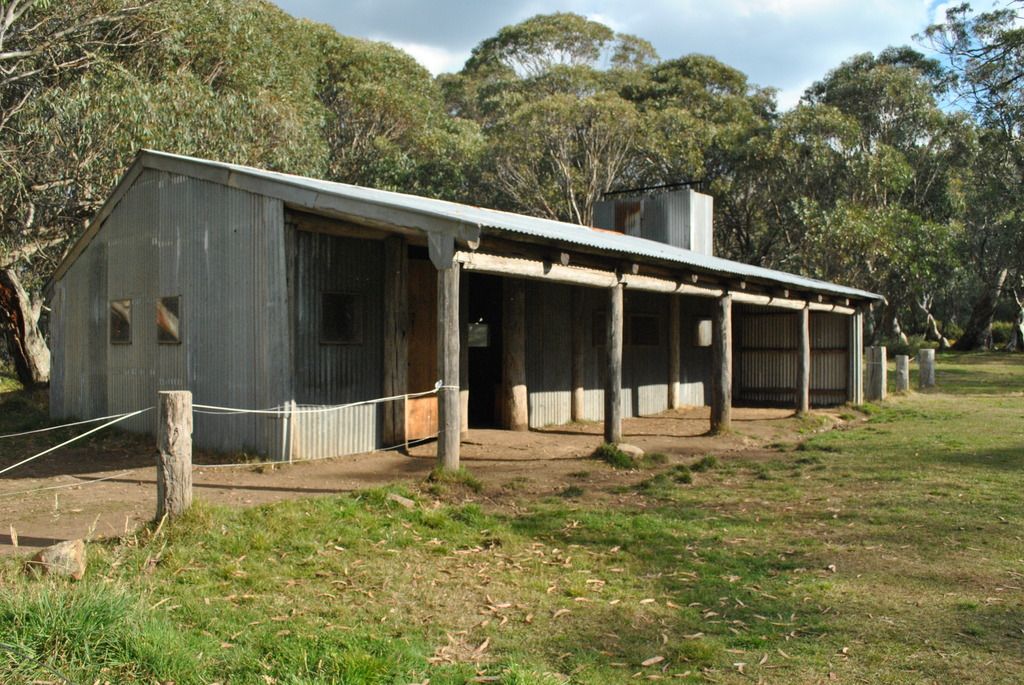
There are a number of huts in this area built throughout the 1900’s. Fry’s Hut was the first of the hut collection to visit. Built in the late 1930’s Fred Fry, a master bushman had a unique style of roof building. The main supports ran the length of the roof, and were pulled in a rolling fashion, up the roof using his horses & chains. Fred also helped construct a number of the other huts in the area. Fred would ride his horse ‘Flourbag’ into Mansfield, some 37km’s away to gather supplies. Fond of a drink or two at the pub, Flourbag was known to carry Fred home across rivers while Fred was asleep. The site is popular with campers, two legs & four. Horse floats are a common sight round this neck of the woods with many trails to be explored either by 4x4’s, horseback, bike or on foot.
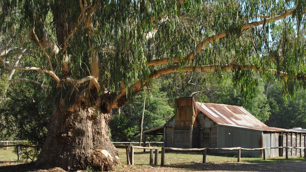
Fry's Hut
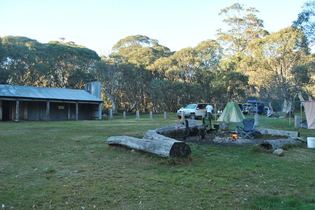
Pickering Hut built in the late 1950’s by Norm Pickering, who didn't use any nails, just a system of groves to slot the materials into place. The current hut has been modified including the use of nails. Nestled on the banks of the river, it remains in the family and is manned to prevent vandalism. We were met by a lovely lady who offered to show us through. Although some mod cons have been added e.g. gas stove & more modern table & chairs, the original layout is exactly how it was. Built with the big opened fire place, a necessity during those cold winter months, it made a welcoming sight into what would have been a cold abode. Many of the following huts we would visit presented that same style of fire place.
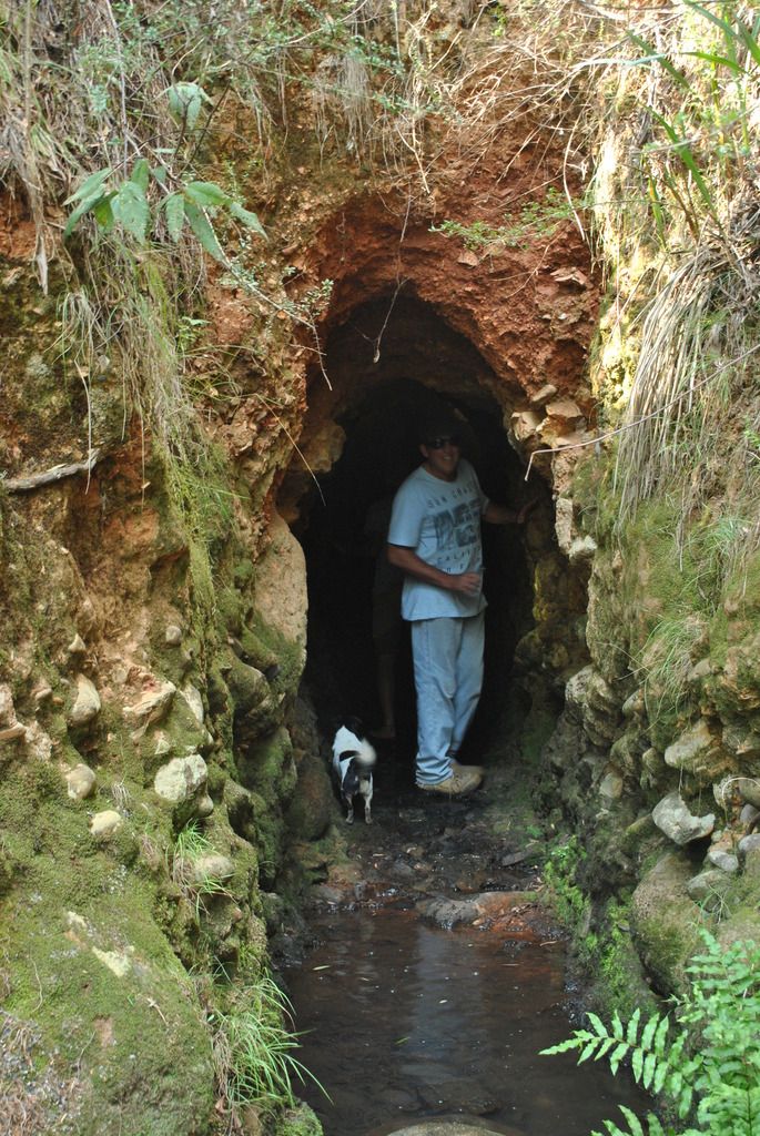
Tunnel bend intrigued me when researching this area. The 100m tunnel was built in 1884 as a link between the Howqua River and the four kilometer hand cut water race to the “Hanney” waterwheel at Sheepyard Flat near Fry’s Hut. A car park just past the campground connects you with the top of the steps leading down to one end of the tunnel. If you have a head for small spaces & a torch you can make the short journey through this tunnel, both ends linking up with the car park. We gained an extra member; a small dog named Scott that took a liking to Tyrell following him through. Thankfully found his owner when emerging from the other end of the tunnel.
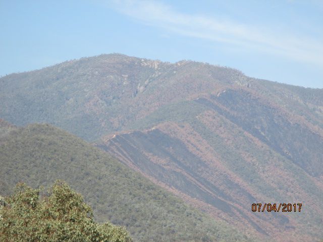
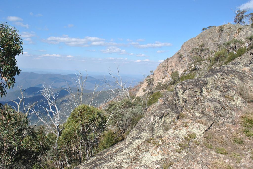
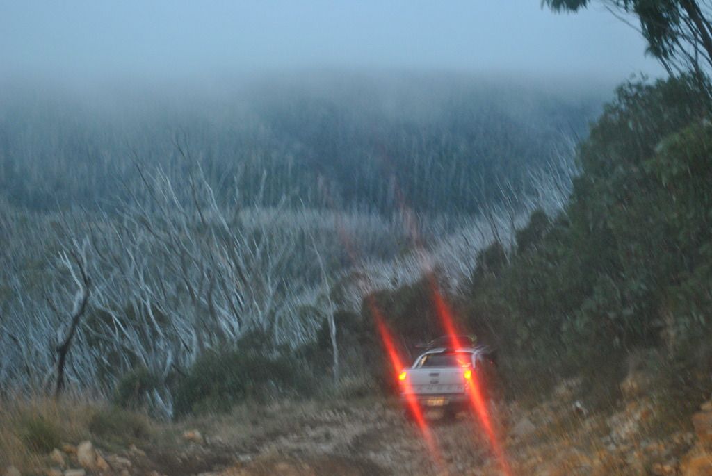
The dieback trees were an interesting site. Stringybark & Red Box trees have been gradually declining in health, and now stand like skeletons in huge tree graveyards. Reasons thought to be of weather conditions, drought. Despite the lack of leaves & dying state appearance, they present a strange sense of beauty spread throughout the mountain ranges.
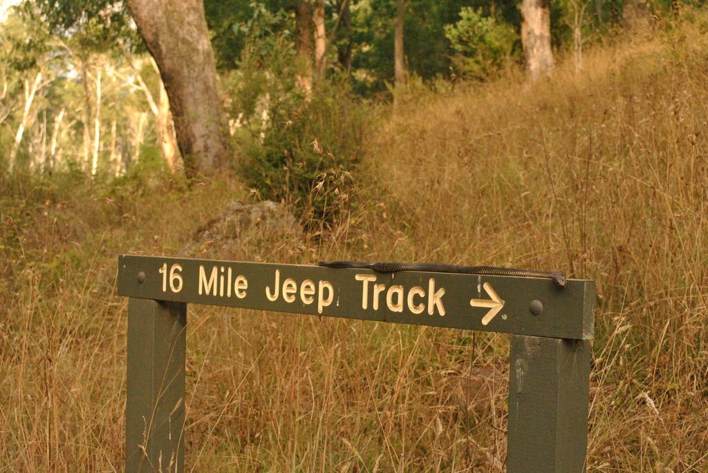
16 mile Jeep track took us down into the valley providing some steep downhill (minor) challengers. After following the river we arrived at Bindaree Hut (Nicked named Hobbit Hut due to its unique size). The hut was possibly built prior to 1926 by Jim Ware. Reports also state Arthur Dale built the hut in the early 1930’s; this hut could be the second on this site.
Dan & Tyrell found a dead snake (much to Keri’s horror) laying it out across the sign post for the Jeep track.
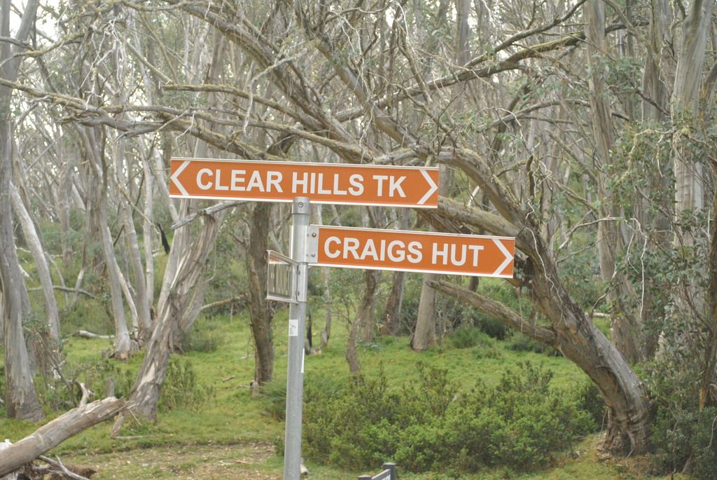
With time quickly ticking on we made a quick dash up the mountain for Craig’s Hut. The monument track provided some steep rocky climbs where low gear was selected, mostly due to the extra weight Paul & Keri were carrying. The main source of trees in this area consists of Alpine Ash & snow gums. Towering well above the road, provides a scenic path up to the car park a short walk from Craig’s Hut.
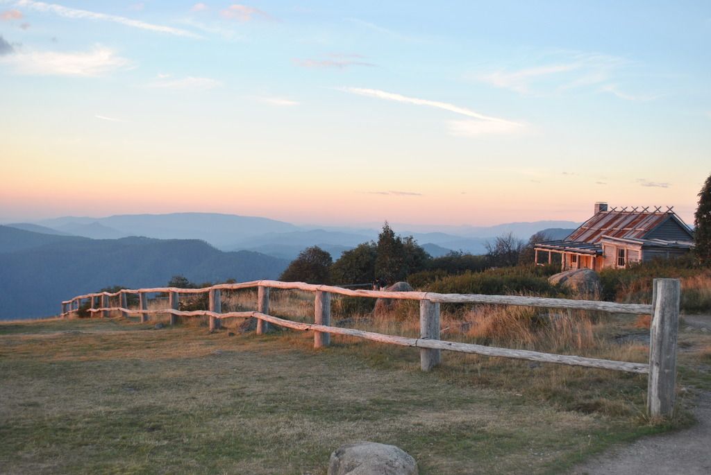
Armed with camera and a sense of excitement of finally reaching this place that has long been on Keri’s bucket list, we make the painstaking journey only to find the sun had gone behind the cloud. Despite this minor technicality many photos were taken.
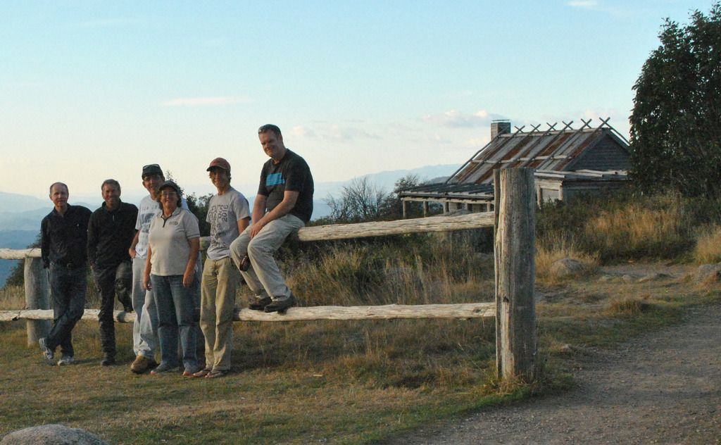
Waiting for the sun to grace us with its presence we decided to have a cuppa then dinner taking in the stunning views despite the lack of sun. They say good things come to those who wait patiently and that it did. With the sun merging from behind the cloud if only for a brief moment, we got to enjoy nature at its best. Some people say the hut is a bit of a letdown due to its film state appearance. It can only be said the combination of the stunning countryside surroundings, the location of a wonderful Australian movie & the outward appearance of the hut itself makes it a ‘must see’ attraction.
We settled on a campsite nestled within the Dr Seuss trees due to their color & weird shaped branches (otherwise known as snow gums). Located a short distance from the car park and with a fire place already set up, made the deciding factor on where to camp. Have to admit it was the coldest night we would experience. The decidedly urgent need for increased supplies of warmies was stepped up dynamically. Dan supplied us with a work site style camping toilet unit to accommodate those urgent calls of nature during the cold nights.
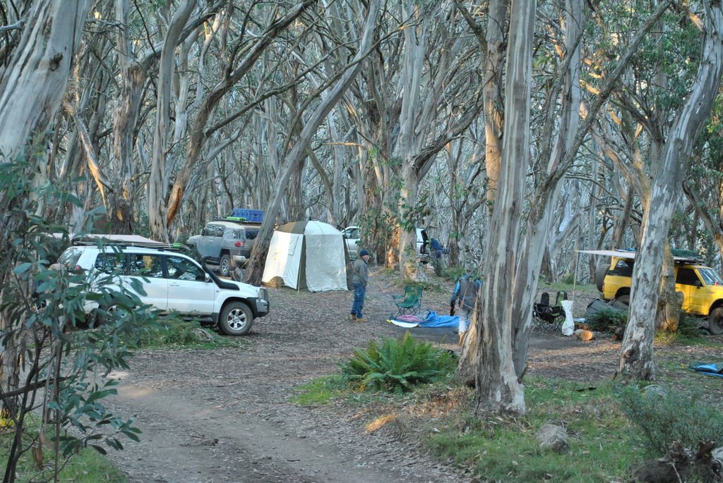
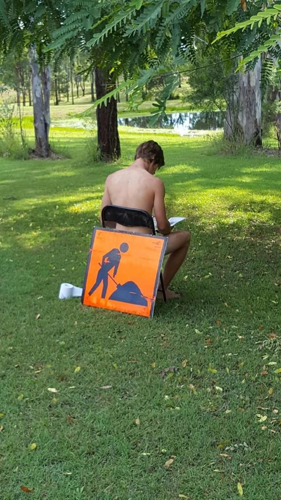
Photo not taken on site
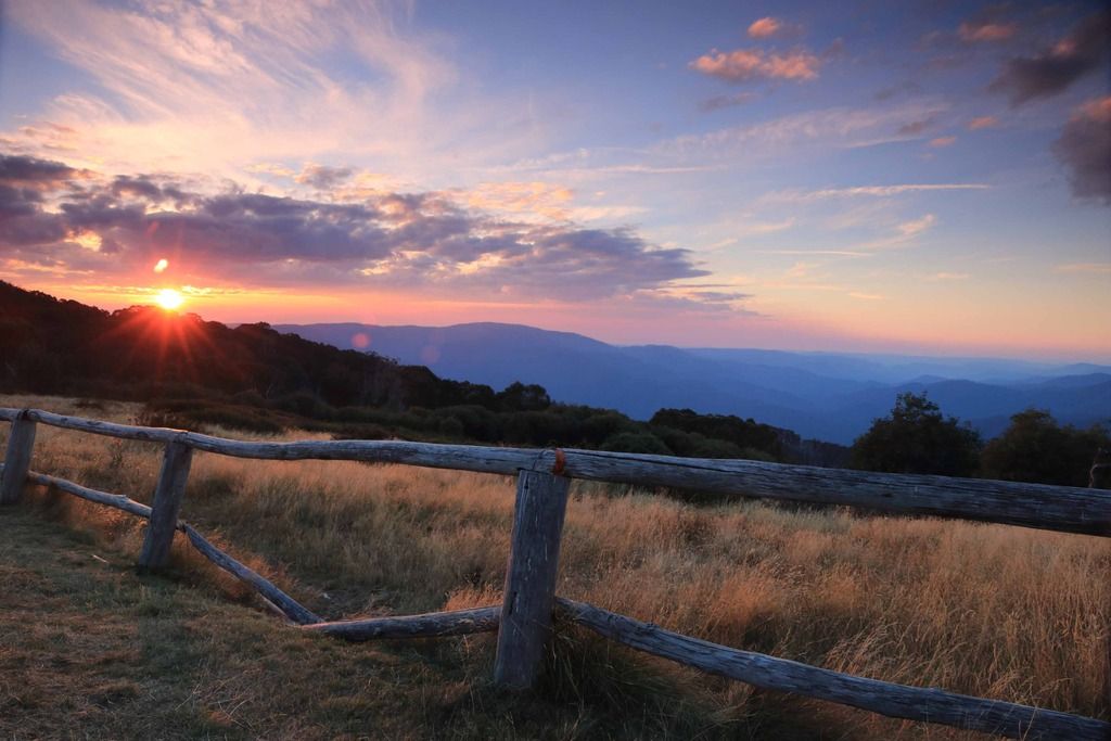
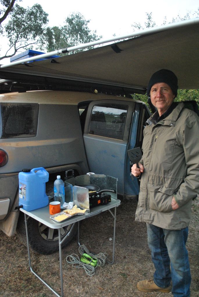
A cool 7°C and fine morning awakes us to catch the sunrise over Craig’s Hut. The plan is to get over to Wonnangatta station by night fall. During breakfast, the group is treated to Don’s camp specialty, croissants with ham & cheese lightly toasted. Yum Keep em coming Don
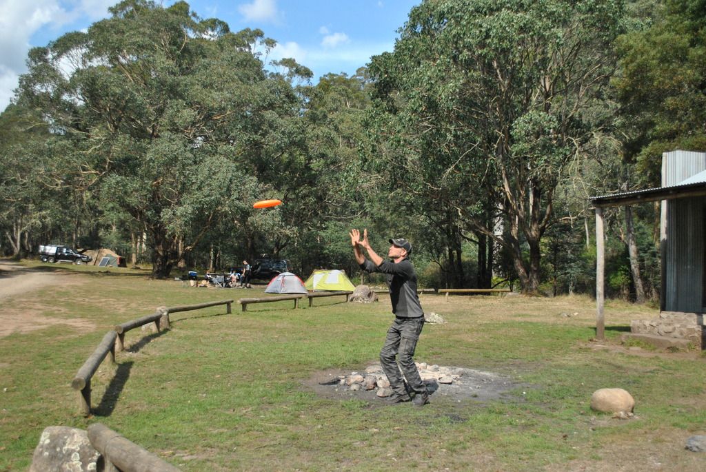
A relaxing drive took us through to Pineapple Flat on the King Basin. King Hut consisted of a few river crossings to get to. Very little water flowing much to our disappointment. Dan bought along a Frisbee to create some fun if we found ourselves getting bored. Although we were far from being bored, it created some extra fun, testing out one’s throwing techniques while avoiding the nearby parked vehicles.
Bindaree falls consisted of a short 20 minute return uphill bush walk from the car park. Although there was very little water flowing, considerably similar to the rivers we had crossed earlier, it made a nice cool relaxing place to visit.
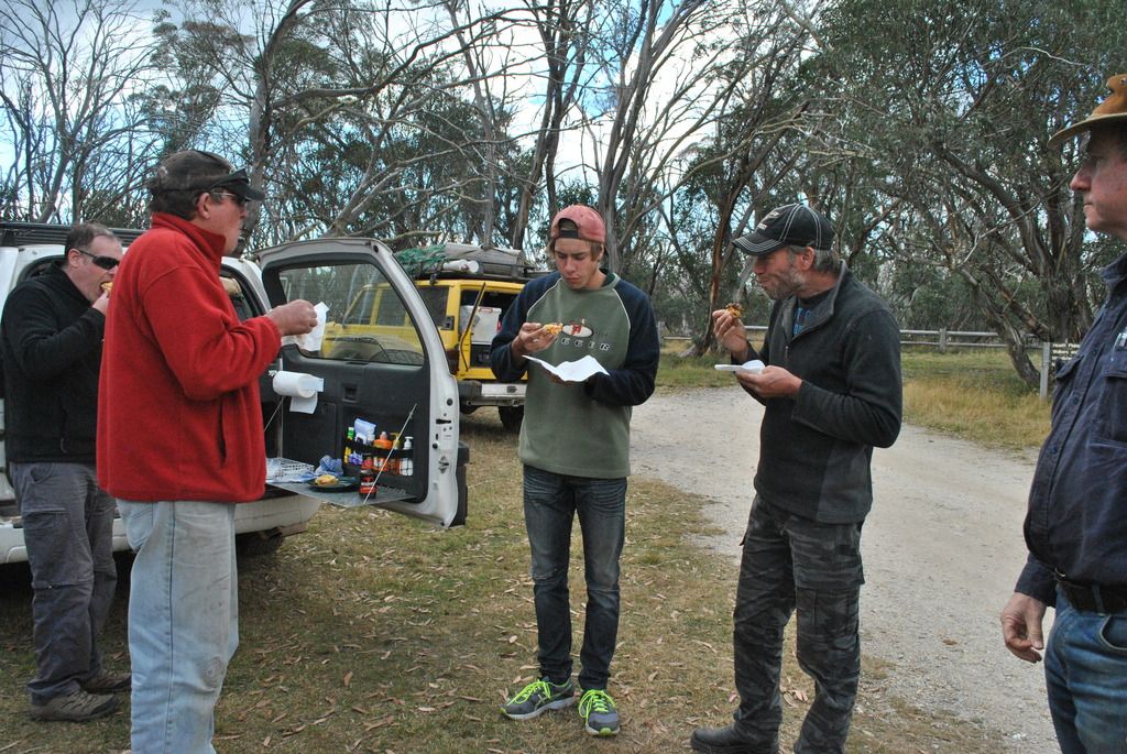
Lunch at Bluff hut turned out to be a life savoir as every man and his dog came through from the track ahead. This track was to be just as slow going as before, not one to be trying to pass other vehicles on.
We were graced with stunning views out over neighboring valleys accompanied with more Dr Seuss trees.
So slow was the going we traveled 5.8km in 1 hour arriving at Lovicks Hut at 3:30pm. We had another 27km’s to travel to reach the next hut. If the last piece of track was anything to go by, staying here was a preferred option. Lovicks Hut presented us with a fire place all set up, toilet facility, running water and lovely bush surrounding. Now who could say no to that
The track from Lovicks Hut was steep & rocky, certainly slow going. Driving through more snow gums and catching glimpses of the stunning views over the neighbouring ranges & valleys, there was never a dull moment. Lunch, we were treated to some freshly cooked hot pies in Paul & Keri’s new ‘travel Buddy’ oven. Despite the fact the pies were slightly changed in shape (all the bouncing round during the steep hill climbs) they tasted great.
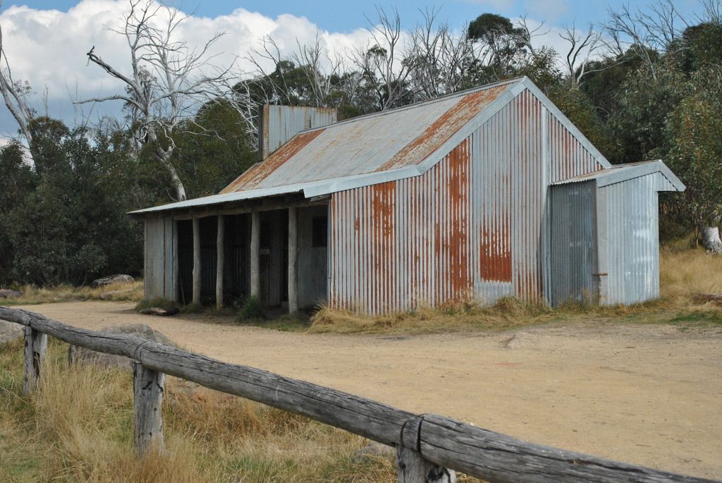
Zeka Spur track to Wonnangatta Station took us a couple of hours to travel. Some steep sections, switchbacks & of course the views; this track was not difficult, just slow in places. Like many of the tracks we have, and would travel, slow and steady got you anywhere you wanted to go. Wonnangatta Station itself was a bit of a letdown after the previous huts. A small hut, (Iron sheeting salvaged after the 1957 fire destroyed the original homestead) and a floorplan laid out in stones and some plaques. Yep - by this stage we had been spoiled by the magnificent High Country Huts.
The Victorian HC atlas placed a caution; steep. Do not attempt after rain. Up until now we had clear blue skies with no sign of changing - so on we pushed. The trail up over the Wonnangatta Track & Heme Spur track was steep but very manageable. While descending back down into the valley by the Cynthia Range track we found ourselves confronted with deer. Too quick for Paul to grab the camera, we missed out on getting a photo of them. Arriving at Dungeys Hut in the fading light, this seemed like a good place to camp. The camp area provided a relaxing location beside the river. Like all the campgrounds we have stayed at, a long drop toilet system was provided & of course top priority, the camp fire.
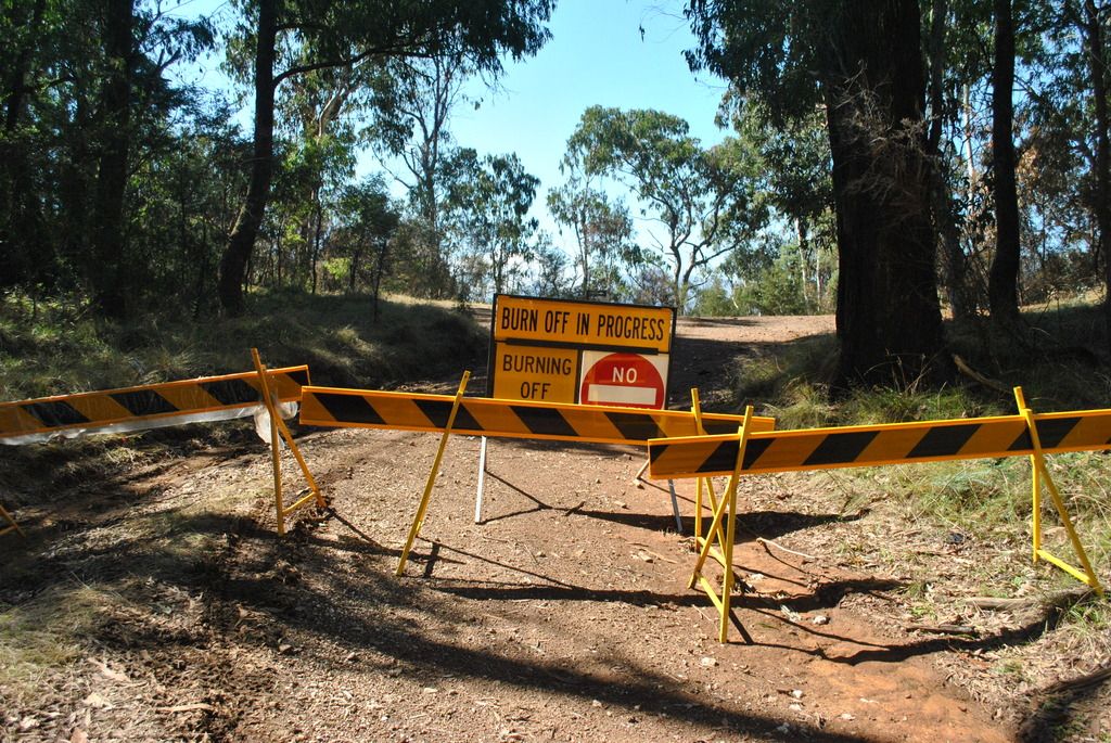
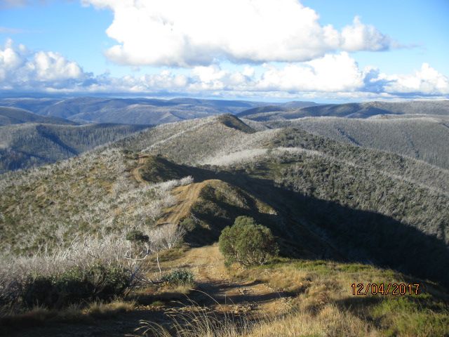
After being closed for the past week due to burn offs, we crossed our fingers and headed to Billy Goat Bluff Track. After a few navigational challenges (and a bit of splashing through Wonnangatta River near Kingswell Bridge) we finally found the start of the famous track. National Parks had done a back burn (hence the track closure) and graded the tracks. I hate to think what the track was like before they graded it. Now it consisted of many rocks making some parts a scramble to get up, not to mention the dust. A young family found themselves slightly over their heads in the challenge the track was providing, Dan encouraged them to follow us, ensuring them he would get them up one way or another. Reaching the top at a height of 1200m, the views weren’t too bad.
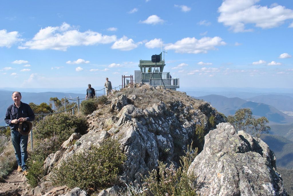
Further along the track you reach the Pinnacles fire tower, again the views breathtaking. A little windy, the walk up was refreshing and good exercise, especially after all the rocky driving we had done getting up here.
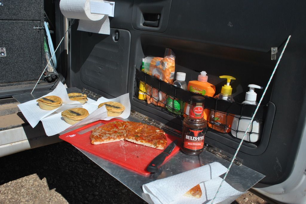
Lunch is up
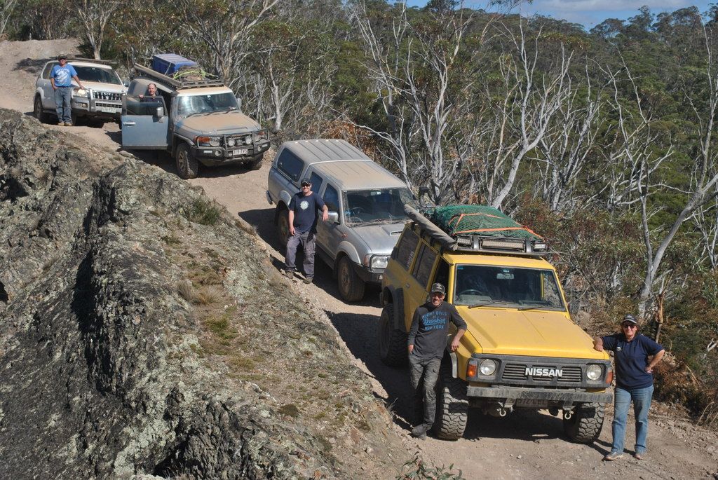
Razorback, Billy Goat Track
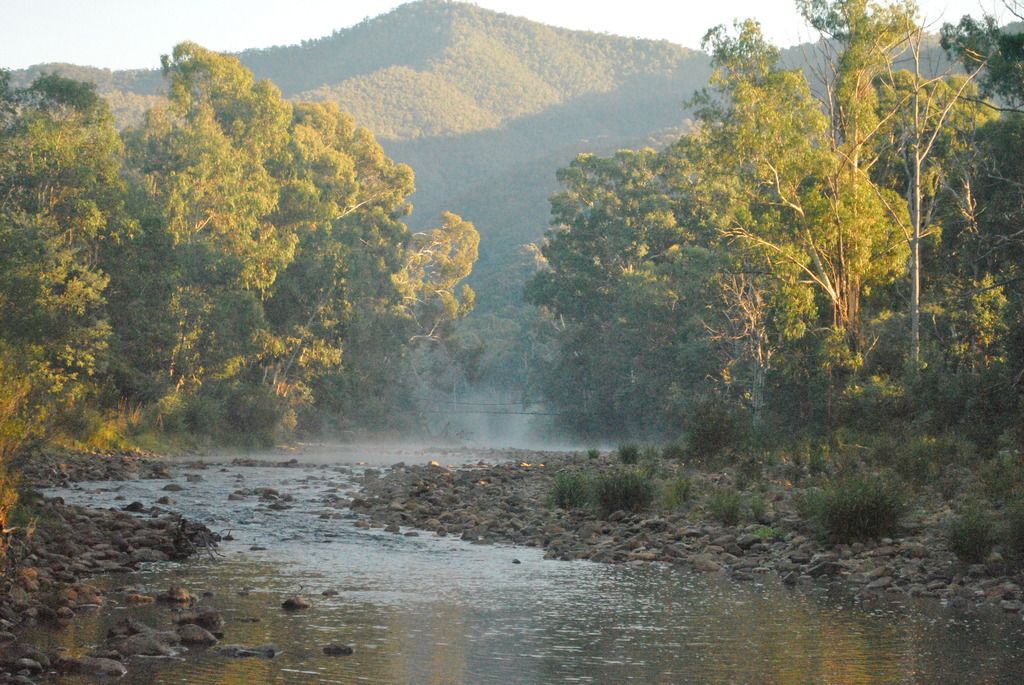
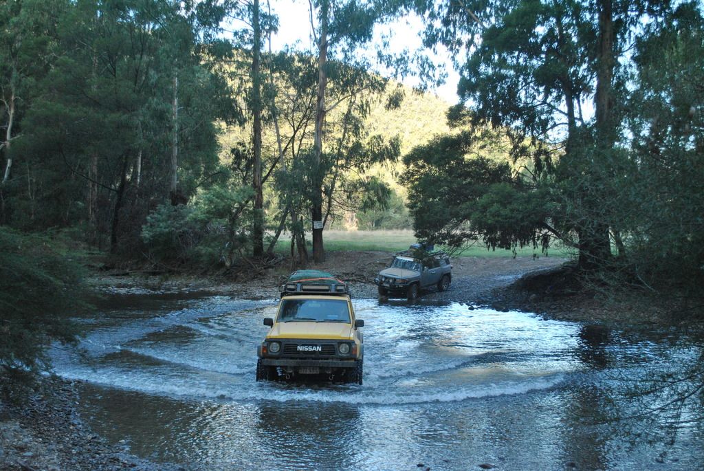
Crooked river (total length, 54 river crossings) we would travel just a few of them today.
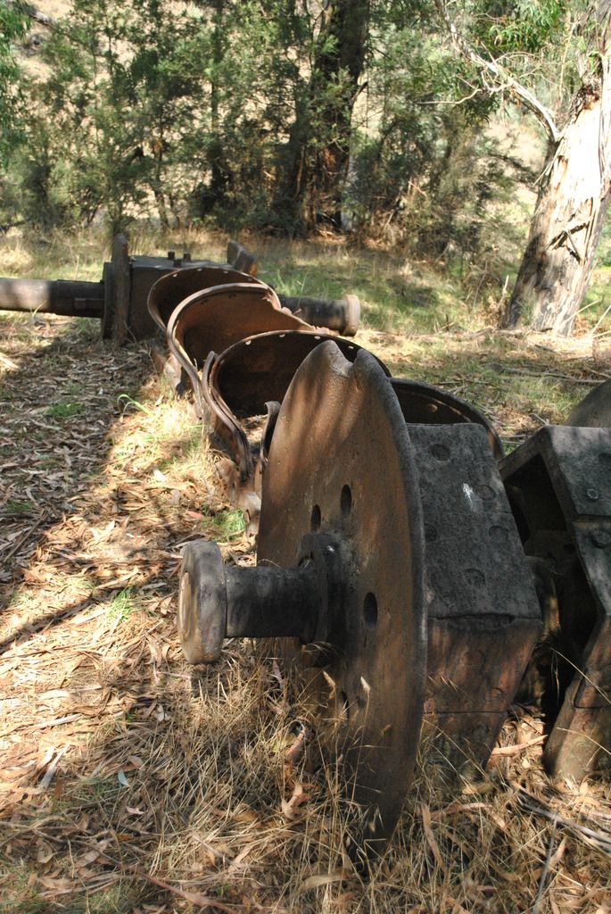
Following the river, the track would lead us through to Talbotville, tonight's campsite. Occasionally one would come across old mining equipment nestled upon the banks where once-a-upon a time were used during the gold mining days.
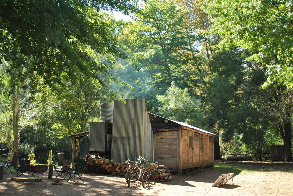
Hobbits Hut, Talbotville
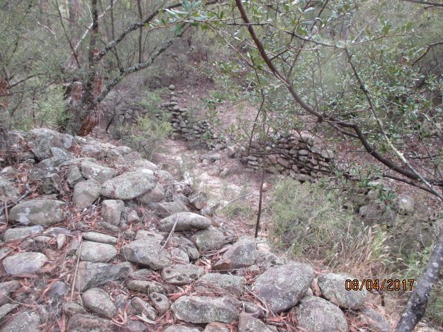
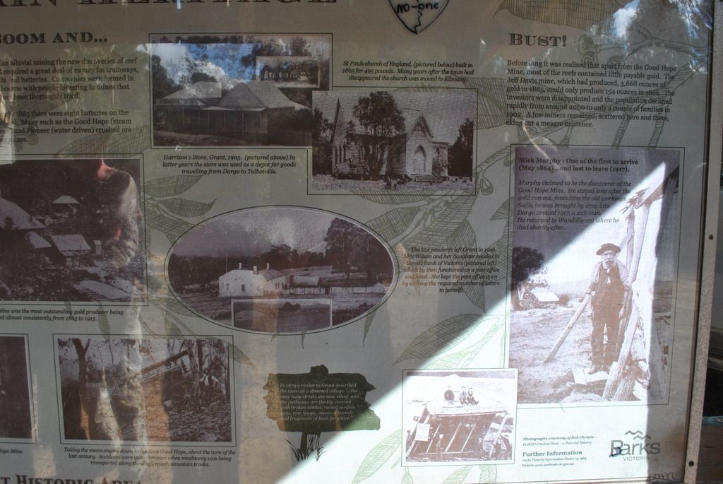
Exploring the Talbotville area was interesting. An info board at the campground describes the, once-upon-a time thriving town of gold miners during the mid-1800 – 1950’s. All that remains is some neatly stacked up rock formations, displaying something of the old township.
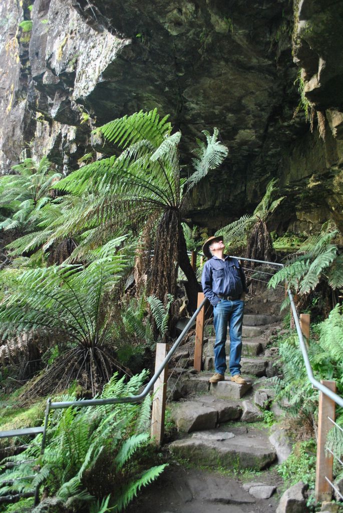
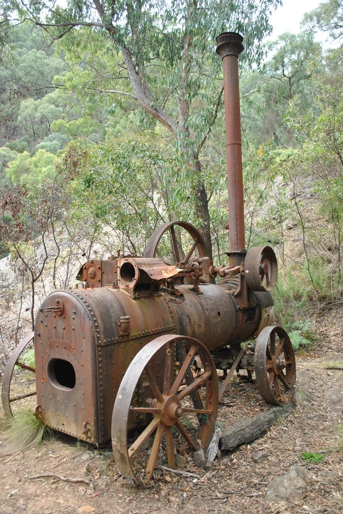
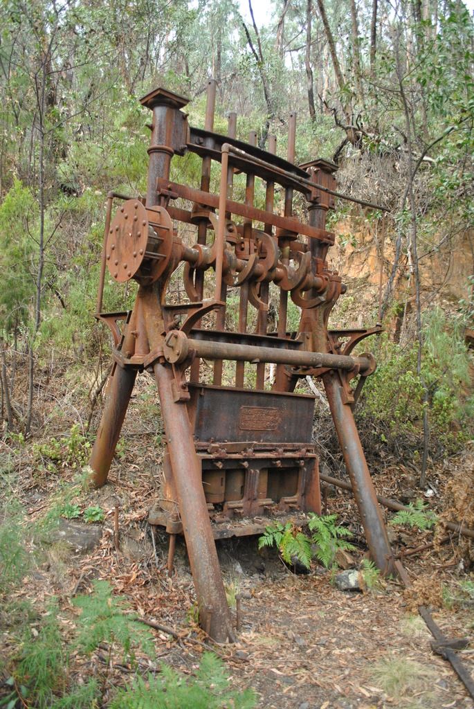
Talbotville & surrounding areas such as Bulltown existed much longer than Grant. From Talbotville the Crooked River Track crosses the river some 23 times and continues on to Stonewall; the site of another old gold mining town. Along the track are many signs of past mining activity – fenced off mineshafts and the Good Hope Mine. A half hour (hard slog for some) walk takes you to the old disused Engine, battery & crusher, a reminder of the works associated with the Good Hope mine.
The tracks including Bulltown Spur Tk & McMillans Road are easy travel so we returned to Talbotville for lunch after visiting Stonewall (Old mining town. No remains to be seen). Collingwood Spur track had come highly recommended for its views. Always up for a new challenge & the opportunity to explore more of this stunning countryside we re-traced our previous days travels along the crooked river to the Collingwood turn off.
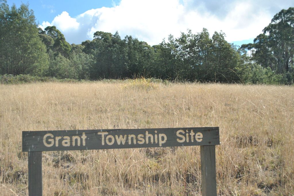
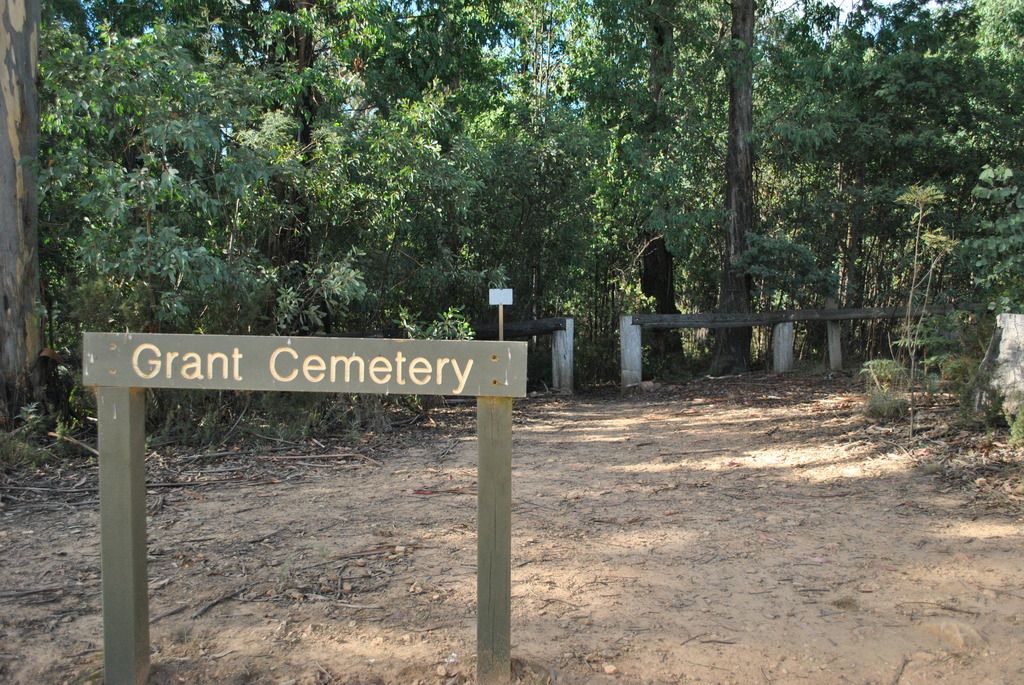
McMillan Road is the site of Grant Historic mining area. Once a major gold mining town during the 1860’s, gold was discovered as far back as 1850. The town consisted of 15 Hotels, a church, courthouse, Police camp, medical hall, numerous stores & newspaper office. By the end of 1865 the population had risen to 2000. Very little remains these days of the township, plaques are displayed where one-upon-a-time a township thrived. The last of the remaining residents departed in 1916, leaving behind only ruins & memories - and plaques.
A sense for more adventure, we detoured off the main track along Hibernia Rd onto Grady’s creek track. This was definitely a fun track and included some steep downhill challengers (don’t forget the dust factor). This wasn’t before running into, well almost, dirt bikes. Bikes seem to think they own the roads, flying round corners on the wrong side of the road.
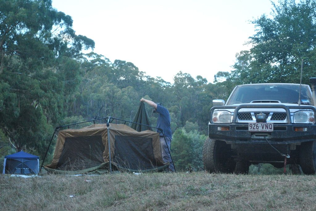
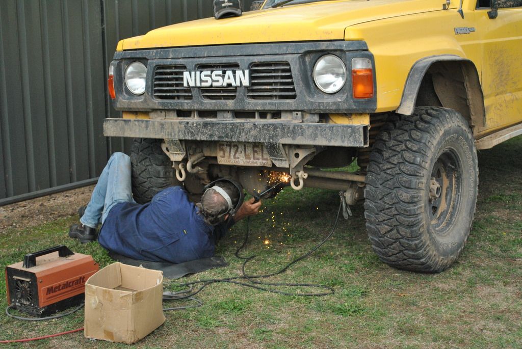
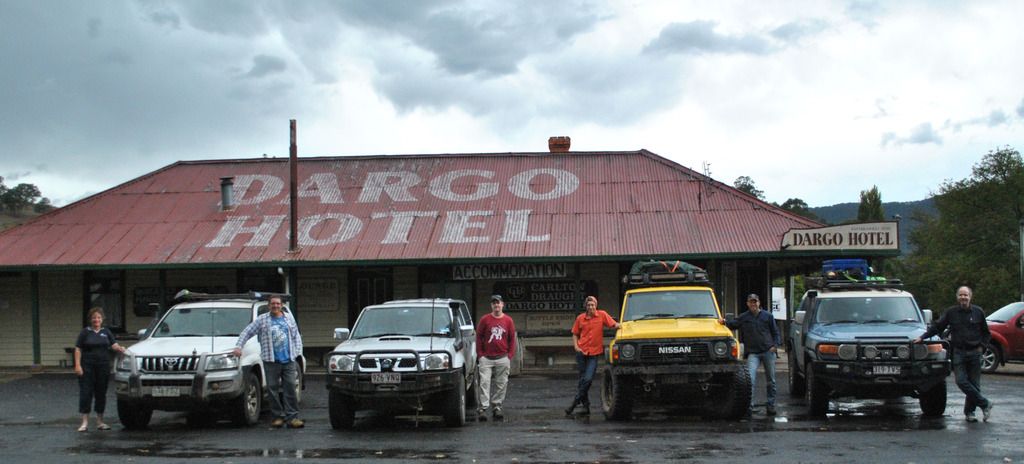
Dargo was a recharging point. Showers had by all and a good old hearty pub meal at the tavern. Days earlier Dan had discovered a crack in his diff. Before leaving for Bright, he set out to find someone with a welder. Thankfully the camp owner had one, allowing Dan to use it. We can safely say this was the worst of our repairs while on this trip.
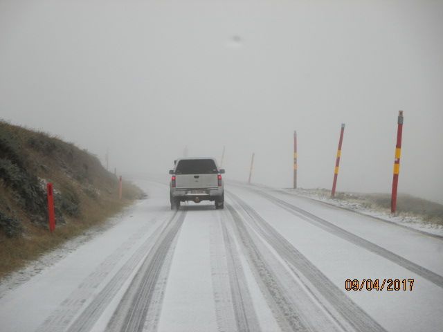
Up until now we had been very fortunate with the weather to date, but storms were blowing in as we leave Dargo for Bright. The clouds roll in and the temperatures drop.
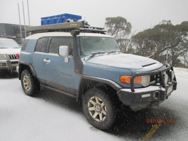
Despite the weather, small detour to check out how the Blue Rag Range track was holding up in the wet weather seemed a popular idea. While we intended to just check out the condition of the start of the track...before long we were at the trig station at 1718 meters. Of course the famed mountain views were obscured by swirling cloud, fog, rain, sleet....and SNOW!!!
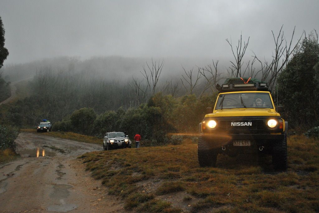
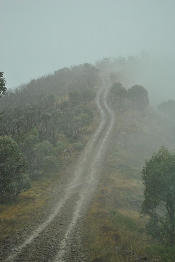
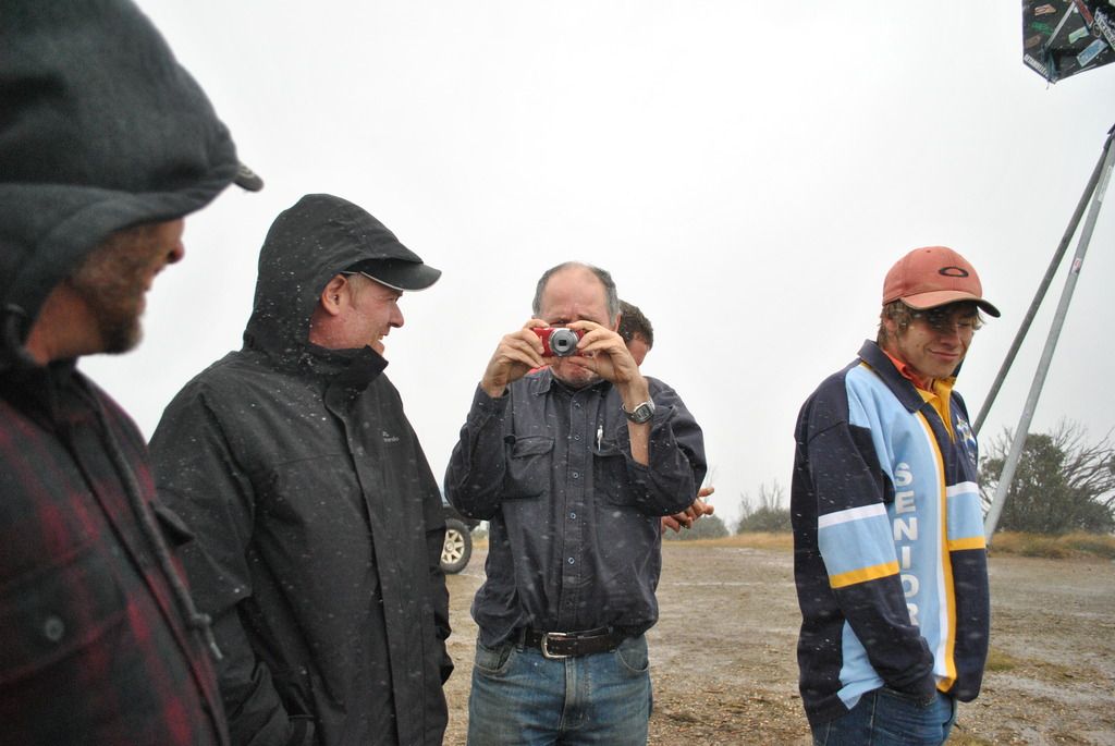
Photo time of fast freezing humans (mortals) destined to die if we stood there any longer.
Mt Hotham presented us with minor snow sludge conditions. Photo of our newest Breakaway member, ‘iceman’ (Not sure if we’ll be seeing him at Fraser Island. Dave thinks he might get ‘cold’ feet)
Never seen in Breakaway history
Thanks to Dan and his expertise in snow driving, guided us down the mountain safely. Compared to conditions he told us about back in Canada, we gathered this was snow driving for “Tiny Tots”.
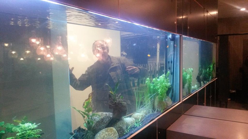
Cabin camping was high on our list since the rain and cold had set in, at least for 4 of us (Dan & Tyrell swaging it again). Dinner was at the local Porepunkah Pub. The restrooms were interesting. A fish tank ran part of the wall in the ladies while the other half encroached on the men’s side. Highlight for kids (and some not-so little kids)
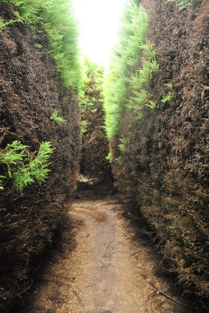
During the night, Mt Hotham received 47cm of snow, and many tracks, including Blue Rag Range were closed. We spent the early part of the morning catching up with washing and shopping, then headed to one of the local tourist attractions just outside Bright - a hedge maze.
As the weather didn't appear to be worsening, we decided to take a run up through Mongrel Creek Road track towards Harrietville for lunch. Keri's new oven got another workout with restocked pizzas. A very nice way to spend lunch on a wet cold day!
The weather graced us with sunshine so the plan was to visit Mt Buffalo and take a walk up to the horn. Unfortunately the road was still closed so we opted to explore up round the forestry tracks facing Mt Buffalo. These proved to be a bit of a challenge for someone (name begins with K & ends in i) the one and only time the winch was ever used. Good views over the township of Bright though.

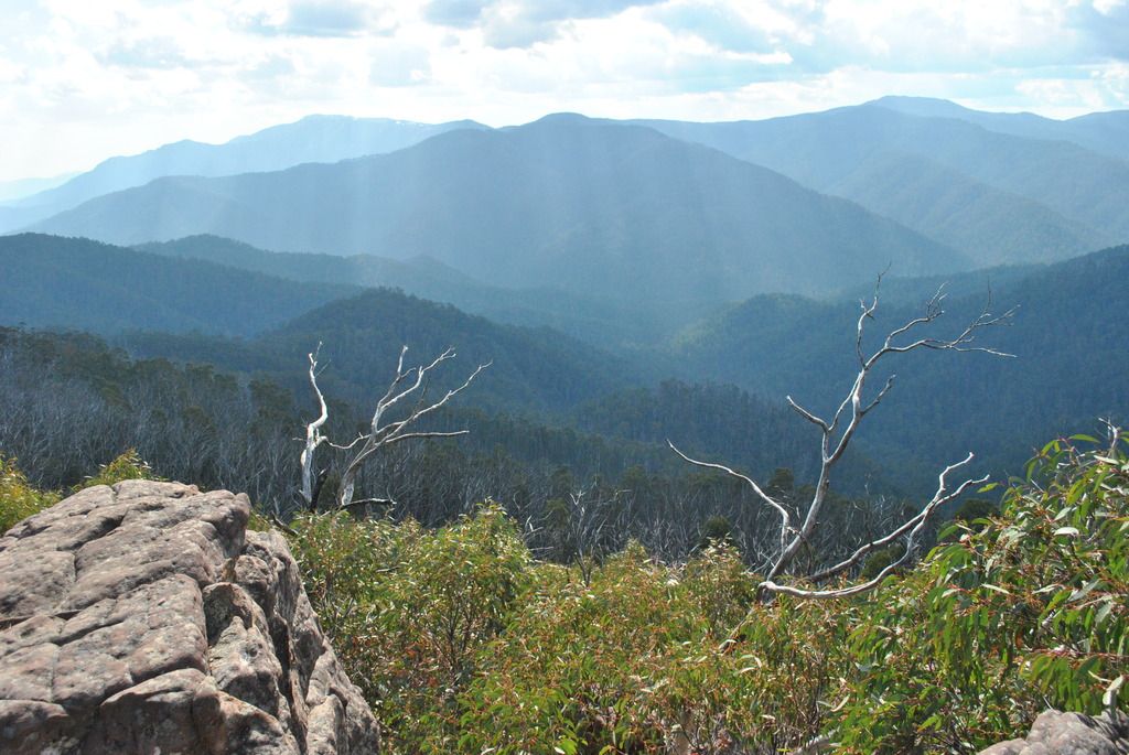
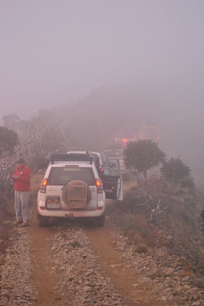
There is one thing to be said for the high country; there is never a track not to be found. The valleys between Mt Hotham, Mt Beauty & Falls Creek offered more adventures. Sadly, after traveling quite some distance a ‘road closed’ sign appeared in front of us.
The funny thing was, there was no smoke to be seen, ever!!
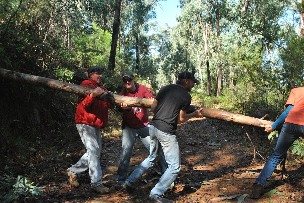
Returning to a T junction, took an alternate route. Again, nearly at the top ‘Road closed’ Grrrrr. It wasn’t all doom and gloom. Not only were there ‘closed road’ signs but fallen trees
Back tracking, yet again, we headed for My Beauty (main road)
Skiing Skippy
Reaching Sullivan's Lookout (view out towards Falls creek)
we ventured onto the Tawonga Gap Track. From there, we don’t remember where. Hey, one can’t get lost forever!!
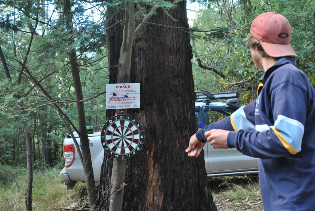
Our last full day on this trip was to explore the Buffalo Range Track onto Twins Jeep Track from Bright through to Dargo High Plains Road, connecting with the base of Blue Rag. This trip would take us from 4 cars to five. Running (not literally) into a couple from Dalby, Liz & Les, like us, enjoying the bush scene was also making their way over to Blue Rag. So we invited them along. Lunch was had somewhere in the valleys over a shot of darts
This track was taking us a bit longer to travel than originally thought; a few short cuts were added in (including some good up-hill scrambles) finally reaching Blue Rag by 4:15pm, with clear blue skies to report.
The track (no through road) continued on down into the valleys below. Due to the previous weather, it wasn't a considered option. With the sun now shining we set off. Unfortunately the track just kept going & going. It was decided to return before losing light. Arrived back at the trig station, again in cloud. This time it provided some stunning sunset photos
It is here where, after 9 days of four wheel driving up round the high country of Victoria we say goodbye to this beautiful part of Australia. The weather has been so good to us. Rain, sunshine, cloud & snow, each weather condition gracing us with its own sense of beauty. They say there is no such thing as bad weather, only bad planning. So we leave Blue rag as we had first visited it, in the cloud
Final day and final meal together was spent at one of the many cafes in and around Bright.
Families flock here in the holidays to camp and to walk, skate or bike ride the many tracks around this area. Although there were a few tress showing their autumn colors, unfortunately we were just a bit too early to see the full display. Hey, you can't win em all.


